A route that looked open yesterday can be restricted today, and a navigation app's suggested shortcut may not explain why. Before a road trip, give official road information its own place in the plan rather than treating it as a last-minute check after the car is packed.
You aren't looking for one page that knows everything about every road. You're building a small set of current sources for the states, local roads, and public lands along the route, then checking what each source actually covers.
Map the agencies along your route
Start with the states you'll cross, including places you might use for an alternate route. The Federal Highway Administration's traffic-information page links to state travel resources, making it a useful starting point for locating the appropriate transportation agency.
From there, save the official state DOT or traveler-information pages you'll need. A familiar 511 label can help you identify a service, but check that the page belongs to the relevant agency and describes your planned roads.
Also identify local, park, or forest roads that sit outside the state highway system. A state map may be useful for reaching a national park while the park's own notices explain restrictions on the final access road.
Put those links in a short trip note with the road numbers and planned arrival areas. That's more useful during a stop than searching the internet again while trying to remember which mountain road you intended to take.
Check what the map layers actually show
Traffic speed, a lane closure, a full road closure, and a weather restriction are different kinds of information. A map with several layers turned off can look reassuring even though the missing layer contains the alert you need.
California's QuickMap FAQ, for example, describes road-condition options for lane closures and road closures. Use that as an example of checking the controls; other states may organize their services differently.
Read the legend before interpreting a symbol or color. If a marker covers a complicated interchange, open its details and identify the affected road, direction, and segment.
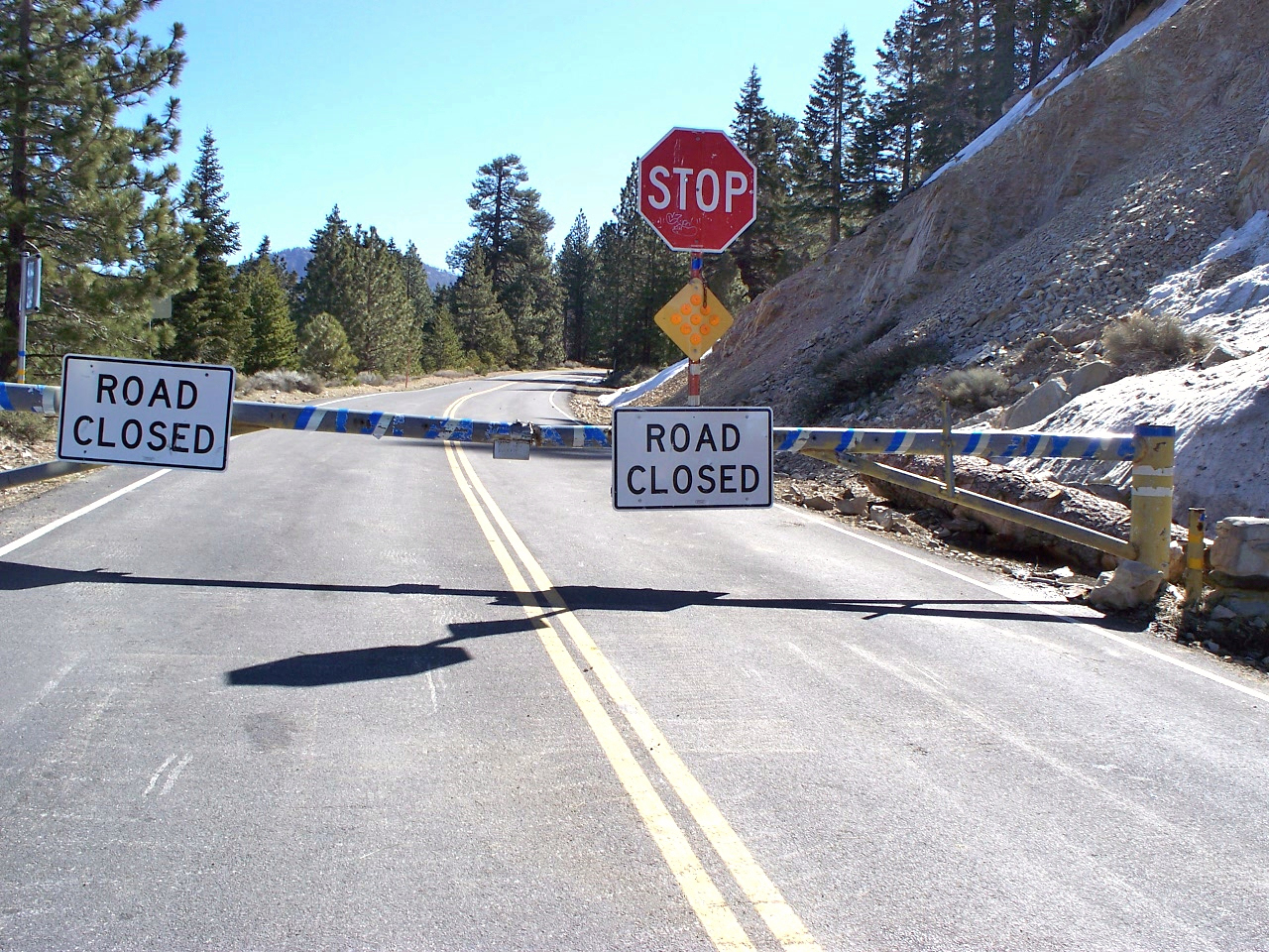
A lane closure might mean a delay, while a full closure might prevent completing the route at all. Don't turn either label into a specific travel-time prediction unless the agency actually provides a relevant, current estimate.

Read the timestamp and the effective period
An alert's publication time, last update, and scheduled operating window can describe different things. Look for the time when the restriction applies, especially when construction work is scheduled overnight or only on certain days.
Keep the time zone in mind when crossing state lines. A plan written in your departure city's time can become confusing when an alert uses the local time at the affected road.
For a simple example, a closure from late evening until early morning might affect your backup itinerary but not your original afternoon arrival. That still deserves attention if a delayed departure could move you into the closure window.
If the notice isn't clear, use the agency's stated contact or information channel. A dated screenshot can help you remember what you checked, but it isn't evidence that the same conditions will remain in place when you arrive.
Separate a weather forecast from a road decision
A forecast describes expected weather, while a road notice describes a restriction or condition reported by the responsible agency. You may need both to understand a route without treating either as a guarantee of safe travel.
Check forecasts and alerts for the areas you'll pass through, not only the city where you'll sleep. Elevation and timing can make a mountain segment different from the conditions at the departure point.
For flooding, the National Weather Service's Turn Around Don't Drown guidance is a reminder not to drive into floodwater. An app route through that area doesn't make water on the road safe or establish that the pavement beneath it is intact.
Likewise, a forecast that improves later doesn't itself lift a closure. Wait for the relevant authority's information and obey signs, barriers, and instructions you encounter on the actual road.
Check alternatives before you need them
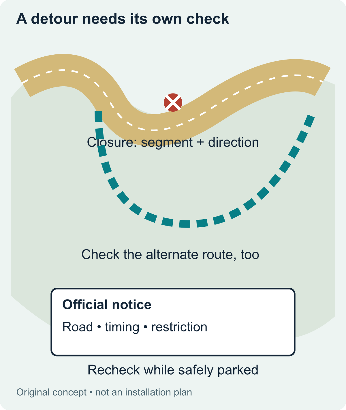
When an alert affects the primary route, look at the full alternate route rather than only the first detour turn. A shorter-looking option may involve a smaller road, different weather exposure, limited services, or restrictions the original route didn't have.
Read the vehicle and road limitations that apply to your trip. Height, weight, trailer, or other restrictions matter when you're carrying cargo or towing, even if a general navigation app offers the route.
Check the appropriate agencies for the alternate route too. A route suggested to avoid one closure isn't useful if its next segment has a separate closure or an access restriction.
Keep postponing or changing the destination among your options. An alternate route isn't an obligation to keep driving when the available choices no longer fit the vehicle, conditions, or time you have.
Plan when you'll recheck information
Make one check during planning, another before departure, and additional checks at safe stops when changing conditions warrant them. The exact rhythm depends on the trip; a short local journey and a multi-day mountain drive don't create the same information needs.
For a longer route, choose a stop before a difficult segment where you can park safely and review updates. That gives you a decision point before entering an area with fewer services or limited opportunities to turn around.
If a passenger is helping, agree on which sources to check and what information they should report. Avoid a string of vague updates when the useful answer is whether a specific road segment is open to this vehicle at the planned time.
The driver should review complicated information while safely parked. Don't let managing map layers, screenshots, and conflicting notices become another task competing with attention on the road.
Keep a fallback for weak cell service
Save essential agency contact information and a basic route record before leaving. Downloaded maps can support navigation in some circumstances, but they don't establish current closure status or replace a road authority's instructions.
If you lose service, don't assume the absence of a fresh alert means nothing has changed. Use signed information and official directions you can access, and stop at an appropriate location to reassess when needed.
Tell someone your broad route and expected check-in plan when traveling through remote areas. This is a planning habit, not a promise that every missed check-in can be resolved by a particular app.
Keep a sensible turnaround or overnight alternative available. A trip plan works better when uncertainty has a place in it, instead of requiring every map and connection to work perfectly.
Use a short departure note
Before leaving, write the roads checked, the agencies consulted, the check time, and any restriction that affects your decision. Include the planned recheck point and the alternate route or postponement option.
Keep that note concise enough that another traveler can understand it. You don't need to copy entire alerts when the essential information is the affected segment, timing, restriction, and official source.
This website provides an evergreen method for checking road information, not a live traffic service. For the conditions on your actual travel date, return to the relevant agency pages and follow the information available on the road.
The aim is a route decision you can explain with current evidence. A few well-chosen official sources, checked at useful moments, are more helpful than a long collection of road-trip links nobody has opened recently.
For a shared trip, give the next driver the saved agency links and the exact road segments you checked. Include the time of the last check and the next planned stop for reviewing updates.
That handover prevents a dated screenshot from quietly becoming everyone's current understanding of the route. The next driver still needs fresh information when conditions or timing change.
Sources and scope
- FHWA: National Traffic and Road Closure Information
- Caltrans QuickMap FAQ
- Caltrans Travel
- NWS: Turn Around Dont Drown
Sources checked October 14, 2026. This guide uses documented information; it does not claim independent product testing or professional inspection.